Friday, April 28, 2006

Dead or Alive.
(1999, dir. Miike)

If Jean Claude Van Damme and Steven Segal were more bad-ass and better actors and harder working and had generated individually massive oeuvres of direct-to-video/dvd crime/cop/mafia flicks and then, finally, for the first time ever, they were in a film TOGETHER and that film is directed by a somewhat cockamamie exploitation on-the-cheap director who realizes the combination of these two grindhouse cinema titans in one film verily DEMANDS that caution & logic be thrown to the wind (at times) since the collision of these two demigodly freight trains dictates this head-to-head conflict be larger than life.


Sho. Badass.

This hypothetical film has never been made.

But if you substitute the imaginary badass version Van Damme & Segal for real-life Japanese grindhouse badasses Sho Aikawa and Riki Takeuchi, and put them in their first filmic outing together (directed by weirdo Takashi Miike), you get Dead or Alive.


Riki. Badass.

As sayeth Riki: "Here comes the fast part."


Sho, one-armed and with a bazooka in the final showdown. Oh, its on!!!!

Read the Midnite Eye article.

Tuesday, April 25, 2006

Portland Heights Cable Car Line.
(1890-1904)

With lots selling atop Portland Heights for $250 a piece, the Portland Cable Railway Co. was incorporated in June 1887 w/ the specific intent of developing a cable-car trolley line to the southwest hills, which in turn would open up real estate development on the s.w. hills. A cable line was laid, running from Irving St. by Union Depot south down 5th to Jefferson, where it preceded west to Chapman Street (modern-day 18th Ave.).

map hosted by photobucket.

From there it continued south on Chapman to Mill, where it climbed a 1,040 foot-long wooden trestle w/ a 20.93% grade (20 feet vertical for every 100 feet horizontal - which, of course, equates a climb in elevation was over 200 feet from Mill to Elizabeth).

Oregon Historical Society collection.
Trestle under construction, November 1887.

It was an expensive & complicated (but impressive) affair, & public operation of the cable-car line did not commence until February 22, 1890, just as the 1st electric trolleys began gliding up & down 2nd Street in January.

Portland General Electric Co. collection.
View of the trestle from the northwest. The houses line Montgomery Drive.

Two days after opening a cable-car left the turntable at the top of the trestle & failed to pick up the cable, so that the car succumbed to gravity and accelerated very quickly. The crew panicked & jumped off the car(!), & the car flew down the trestle, w/ 3 passengers on board, until it overturned at the curve onto Jefferson (no one seriously hurt).

Portland General Electric Co. collection.
Passengers transferring from electric cars to a trestle-bound cable
car at Jefferson & Chapman Streets (Chapman is now 18th).

Despite completing the line & plans to extend the line west to Canyon Road at Sylvan (and from there to Beaverton), the Portland Cable Railway Company was spending all its capital on construction & not coming close at all to breaking even in revenue, & declared Bankruptcy in early July, a mere 6 months after commencing service.

Oregon Historical Society collection.
Cable car descending at S.W. 18th & Clifton, a few blocks above the trestle.

To add insult to injury, on July 11th, Car No. 13 broke loose from the cable at the powerhouse & rolled down 18th to Jefferson where it overturned. Car No. 18 then did the exact same thing & slammed into the overturned Car 13!

Gertrude Jensen collection.
Cable car in front of powerhouse & shop at Mill & 18th.

Today the above-pictured powerhouse & shop is technically underneath the approach to the Highway 26 Tunnel. I find this view, looking up the trestle from its base, is one of the more visually striking images of the trestle. How could this trestle NOT dominate the landscape? For me, its existence has the additional attraction of being built in less, uh, litigious times: there are no railings on the trestle and the cable-cars appear to be entirely of the "open" variety.

Portland General Electric Co. collection.
Two cablecars pose on the trestle (see, everyone is looking at the camera).

The bankrupt line was sold in public auction to a bank, who immediately incorporated the City Cable Company to continue operations. The line eventually came under the aegis of the Portland Traction Co., which converted it to electric power in 1896, w/ the exception of the trestle: cable cars continued to make the climb & descent between Jefferson to Spring streets.

Cable car service continued until all-electric service to Portland Heights & Council Crest became possible in 1904 with the completion of the Vista Bridge.

Monday, April 24, 2006

Depot-Morrison Line.
(1907-1923)

That's "Depot" as in "Union Depot," as in Union Station.

An amalgamation of pre-existing trolley lines (horse-drawn, cable, and electric) laid down by previous trolley companies, the Portland Rail Light & Power Co. Depot-Morrison Line's immediate predecessor was the City & Suburban Railway's "M" Line (Morrison), established in 1892. Sections of the line also included track laid by the Transcontinental Street Railway Co. in 1883 for horse-drawn trolley cars and cable-car tracks set down by Portland Cable Railway in 1890.

Oregon Historical Society collection.

Morrison-Depot No. 632 at 5th & Morrison,
turning onto a switch (circa 1915).

As the 1905 Lewis and Clark Exposition drew closer, both the City & Suburban and Portland Railway Companies (both of which would merge in 1904 before the Expo began anyways) girded themselves for the expected onslaught of visitors to Portland (despite the name, the Lewis & Clark Expo was that year's one and only world's fair). The Depot-Morrison was the City & Suburban's direct feed to the gates of the expo (at N.W. 25th & Upshur), and stairs were built at the stops along the line for ease of access.


The line continued under the eventual administration of the PRL&P Co. in 1906, until 1923, when it was folded into Willamette Heights Line.

Broadway Trolley Line.
(1903-1948)

When the Broadway Line commenced in 1903, it originally ran from a downtown terminus loop of Burnside-5th-Washington-2nd. The trolleys crossed the Burnside Bridge then continued north on Union to N.E. Broadway and then to eastern terminus at about 21st and Broadway.

Broadway car 813 at the line's eastern terminus.

In 1909-1910 the line was expanded in spurts east and north to its final terminus at N.E. 29th and Mason. In 1913 original downtown loop was abandoned and the line re-routed across the new Broadway bridge. The line ran south on Broadway to its western terminus at Jefferson.


The Broadway was a prestigious line, serving as it did the downtown theatre and shopping district and more-upscale residential areas of northeast. In fact, the line received the last order of brand new trolley cars: fifteen 1932 J.G. Brill Company "Master Unit" cars, which were almost exclusively assigned to the Broadway line.

One of the J.G. Brill Co. "Master Unit" trolleys.

The line was converted to gasoline autobus in 1948. The Brills continued service on other lines until 1950, when the last trolley lines operating in the city proper ceased entirely. The Brills were then conscripted into the Oregon City and Bell Rose interurban lines.

Sunday, April 23, 2006

Chinese Shanties.
S.W. 18th & Salmon (c.1905)

The chronicle of Portland's Chinese immigrant community is a convoluted and, sadly, decidedly grim more often than not. The Middle Kingdom extended roots to Stumptown starting in the 1850s, and grew despite shifting immigration legislation and bigotry to become the second biggest Chinatown on the Pacific Coast, a status it retained until 1900.

For most Chinese, work was circumscribed to hard manual labor. But for a few, somewhat more urban jobs were available: in housework, cooking, laundry-cleaning, gardening and/or selling vegetables. Thus it came that the outskirts of the city were apparently ringed with makeshift dwellings where the Chinese grew vegetables which they sold in the city.

Oregon Historical Society collection.
A Chinese garden and shanties at present-day S.W. Salmon & 18th, c.1905.

These gardeners actually supplied a significant degree of Portlanders with their fresh greens. Vendors would sell them from two large baskets, each suspended from a long pole, which was then slung over a shoulder.


-d.d.

Saturday, April 22, 2006

Mount Tabor No. 52 Jumps Track, Killing 4.
(April 28, 1897)

In 1897, what we now know of as E. 7th Avenue was a inland slough to the site of the Hawthorne Springs. Morrison Street crossed this slough by means of wooden trestle.

Rather than laying two sets of tracks parallel to eachother all over the city, an expensive task, trolley companys would lay one set, and every so often split the rails into two sets occasionally, so when two trolleys going in opposite directions came up each other, one would stop, and allow the other to pass on the other half of the split. There was such a split on or near the trestle.

On April 28th, Car No. 52 of the Mt. Tabor Line (operated by the City & Suburban Railway Company) was crossing said trestle too fast, and when the Pullman-model car hit the switch, she jumped off the track, and crashed through the trestle's railing and into the waiting slough, turning upside down in the process.


Three passengers were killed, and another died later of injuries sustained in the wreck.

-d.d.

Brooklyn Trolley Line.

The Brooklyn Line (1903-1927) was the child of the approaching apex of the trolley boom years in Portland. The City & Suburban Railway Company commenced service in 1903. The line's western terminus was a downtown loop between 3rd and 1st Streets, crossing the Morrison Bridge, turning south on Grand, then east on Woodward and Powell before reaching its southeastern terminus at 21st and Bush.

image hosted by Photobucket.


A 1904 map of the City & Suburban and the Portland Railway Co./Oregon Water & Power Co. trolley networks shows three large buildings designated as the "S.P. Car Shops" to the immediate south of 21st and Bush, around-abouts 23rd & Gladstone or so. Its worth noting that competitor Portland Railway/Oregon Water & Power ran the Hawthorne Line to the north and the Sellwood line nearby to the west on Milwaukie Street. That said, its a fair guess the intention of the Brooklyn line was to poach fares from the Brooklyn railyards, especially the adjacent shops.

image hosted by Photobucket.
Brooklyn Car 216.


In 1927 PEPCO folded the Powell & Bush sections of the line into the Bridge Transfer Line.

In the following photo we see a C&S-era "Brooklyn" trolley on downtown Morrison Street during the 1905 Lewis & Clark Centennial Exposition. The car is signed for "Powell & Car Shops."

image hosted by Photobucket.
City & Suburban Brooklyn Line Car 18 on W. Morrison c.1905


Note the near continuous line of cars waiting on the track, presumably heading northwest to the fairgrounds.

-d.d.

Liberty Temple.
(1918-1920)

World War I was financed through the sale of war bonds (somewhat more enthusiatically called "Liberty Loans"). Each state was given a bond quota, although there were multiple bond drives.

For the third Liberty Loan Drive Oregon's quota was $18,495. To facilitate the drive a Temple to Liberty was constructed downtown on Sixth between Morrison and Yamhill streets, and really, it was ON Sixth. In the photo its clearly just butted up against the southeast corner of the Portland Hotel on the right!

Materials and funds were donated and the basic structure raised in just three days.

Oregon Historical Society collection.
6th Avenue between Morrison & Yamhill Streets (1918).


Styled in the manner of Antiquity, with two (not-to-scale) replicas of the Statue of Liberty out front, the Temple served as HQ for the Loan Drive and a staging area for rallies. It also served as an employment bureau.

After the war the Liberty Temple was relocated to Park and Salmon (I mean, its IN the street), then torn down in 1920 (built in 3 days, after all).

-d.d.

Thursday, April 20, 2006

St. John's Trolley Line.
(1888-1937)

In late 1888 the Willamette Bridge Railway Co. began a short steam-motor line which ran from a northern terminus at Burlington Street in St. Johns to Stanton & Commercial in the town of Albina, which served as a transfer point to the first Oregon electric streetcar.

image hosted by Photobucket.


In 1903 the City & Suburban Railway Company electrified the line and extended service into downtown.

image hosted by Photobucket.


Line converted to trolley bus April 11, 1937. The gas ones followed in 1958.

image hosted by Photobucket.

Hawthorne Trolley Line
(1889-1936)

The Hawthorne Line was started by the Mt. Tabor Railway Co. in 1889, with what was known as "steam-dummy" service, wherein a small steam engine basically gets a box built around it to give it the more sophisticated appearance of a true cable- or electric-streetcar.

image hosted by Photobucket.
A steam-dummy trolley


The dummy line simply ran from on Hawthorne from Grand Ave. out to 54th Avenue.

image hosted by Photobucket.

In 1891 the East Side Railway Co. purchased the Mt. Tabor Railroad. The ESR Co. had right of way on the old Madison St. Bridge (replaced by the current Hawthorne Bridge in 1910), which had just been completed. The line was thus connected to downtown Portland and the ESR electrified the line between 1892 and 1893. The line continued to expand southeastward during the next few years to its eventually eastern terminus around S.E. Woodward and 74th Avenue.

Photo from PDXHistory.com

In 1907 PRL&P made the Alder Street Loop its western terminus. In 1936 the Portland Traction Company (the intermediary company between PRL&P and PGE) the line was converted to electric autobuses, and then gasoline buses around 1949.

Irvington-Jefferson Streetcar Line.
(1890-1938)

The Irvington-Jefferson line provides a convenient illustration of trolley history Portland. The line was comprised of two older lines, each of which in turn was also made up of pre-existing lines.

What would become the Irvington Line began as the Holladay Addition Line in 1890. However, its operator, the Willamette Bridge Railway, was acquired the following year by the then most extensive street car company west of the Mississippi, the City & Suburban.

The precursors to the Portland Railway's Jefferson Line also launched in 1890 through segments of the Portland Heights line, and 1892's City Park line. In 1904 Portland Railway and the City & Suburban merged to form the PRL&P Company, and in 1914 that operator linked the eastside Irvington line with the westside Jefferson.

Stephen Kenney Jr. collection.
Irvington!! Represent!!

The consolidated line ran from a western terminus at 18th and Jefferson, down Jeff to Fifth, then north to the Steel Bridge. From there it jogged up Holladay and Multnomah until heading north on E. 15th to its eastern terminus at Prescott.

Stephen Kenney Jr. collection.


In 1933 Jefferson street service was dropped, and service continued on the remainder of the line under the moniker of Irvington Line.

The gasoline autobuses came in 1938.

Sunnyside Trolley No. 656 stopped at SE 33rd & Belmont, c.1915


The building(s) to the immediate left are, of course, gone today, having given way to the Belmont Dairy, which was susequently converted and renovated into a Zupan's.

This picture surprised me because the buildings on the block on the left are totally intact and standing today.

Car 656 was a 1911 America Car Co. Class K, the same make and model as the cars which were involved in the three-trolley orgy of destruction at the end of 1915.

Photographs such as this drive home to me the rather obvious fact that we modern-day Portlanders are (still) living in the Portland built about 100 years ago: a surprising number of the buildings still stand, and the various commerical districts are essentially clustered around trolley stops or junctions.

Wednesday, April 19, 2006

Map of PDX's Historical Trolley Lines.


Navigate using the above window, or go see the maps in its entirity.

Public Utility Building.
920 SW 6th Ave.


Built in 1928 by Portland Railway, Light and Power Company (today's PGE), the neon crown atop it (proudly? defiantly? hubristically?) trumpted POWER, HEAT, LIGHT, GAS in each cardinal direction. This was the building built by the trolleys that built Portland, make no mistake.

At 16 stories of Italianate power, in 1957 the lower north and south wings were raised to their current height of 12 stories each.

Today its sort of boxed in by taller, more modern (and blander) buildings.

-d.d.

Sellwood Trolley Barn
(1905-2005)

image hosted by photobucket.
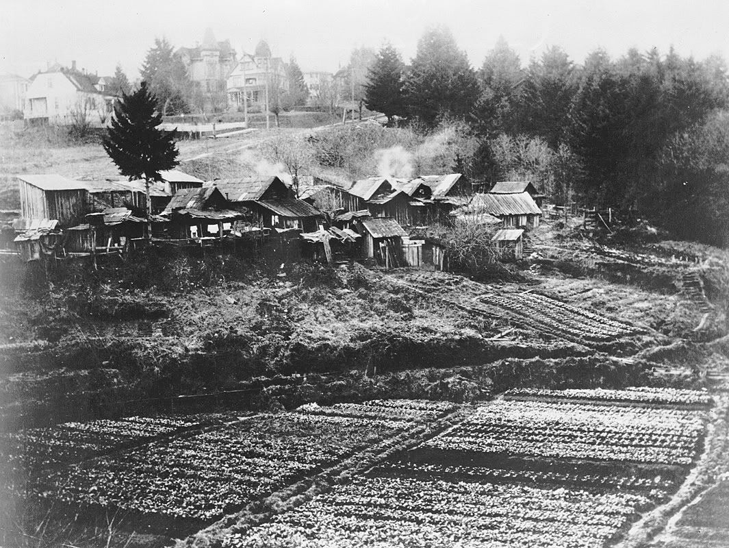
the barns viewed from the west.


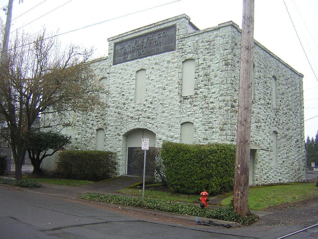
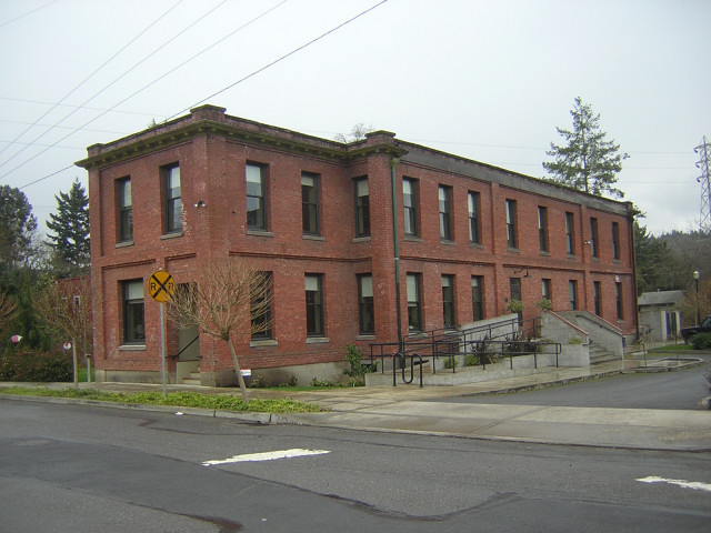
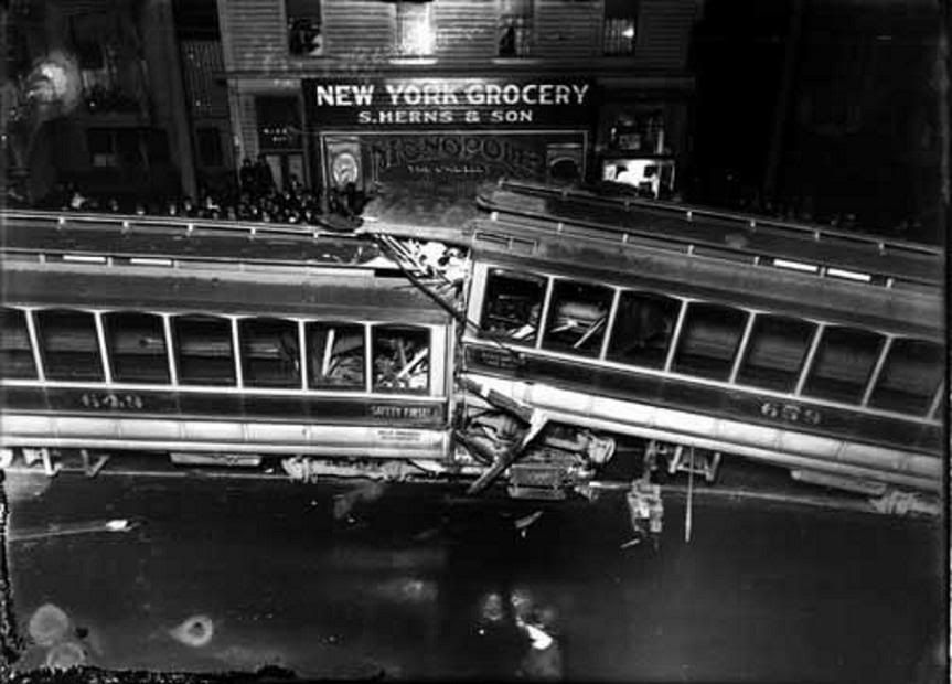
In 1905 the Oregon Water, Power & Railway Company constructed a large complex for its southern east side operations. In addition to a power substation (still standing today, safe on PGE property) and administrative building (still standing, albeit remodeled into offices spaces), a cavernous trolley barn was built between the two smaller buildings. Although this building was just recently demolished, GoogleMaps' satelliete option still shows the barn.1

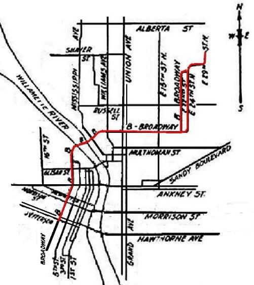
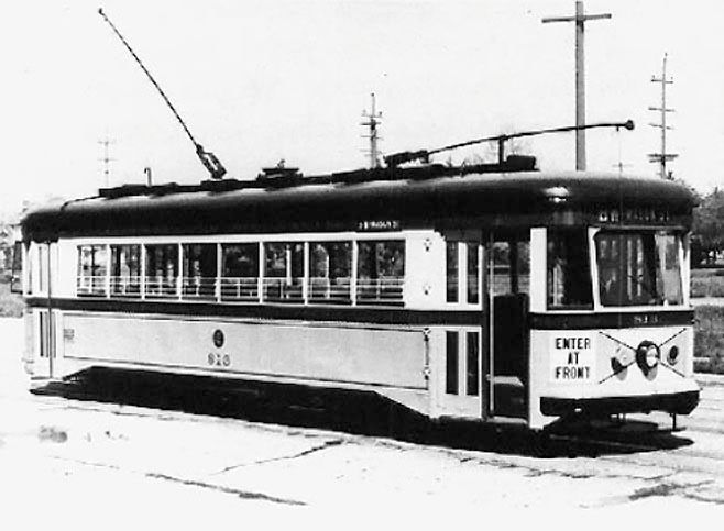
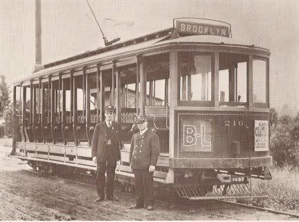
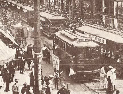
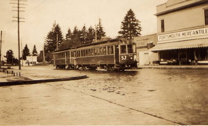
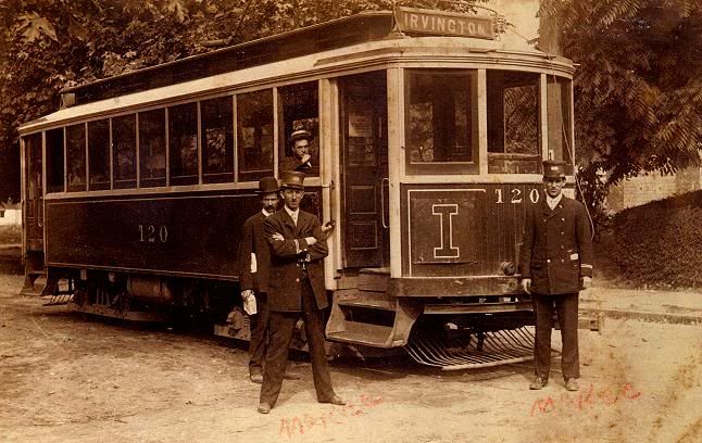
Most likely, cars of the Sellwood, Eastmoreland, and Errol Heights Lines operated from this barn, in addition to housing cars from lines running further north. Also, at adjacent Golf Junction, passengers transferred to the Estacada and Cazadero (both running east) Interurban lines.

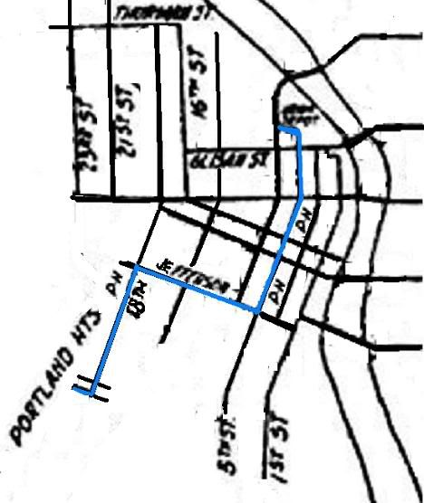
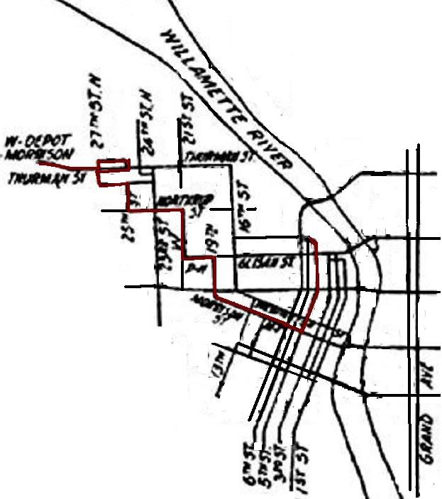
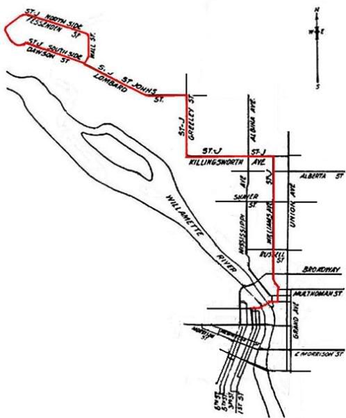
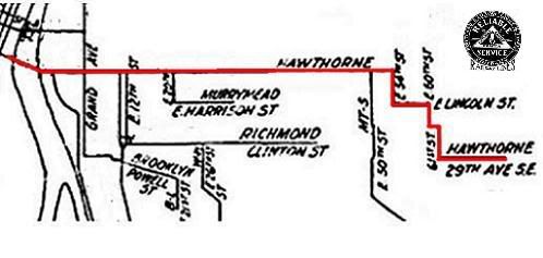
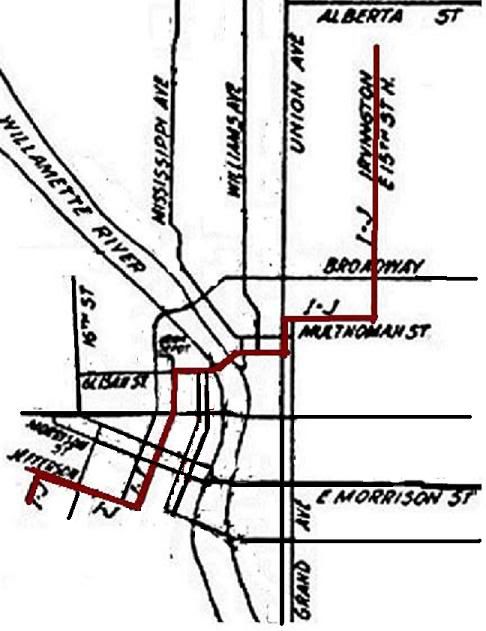
The following detail from a 1918 PRL&P Co. map details the complex network of tracks that fed over 100 trolleys serving the whole city into this (along with four others) barn.


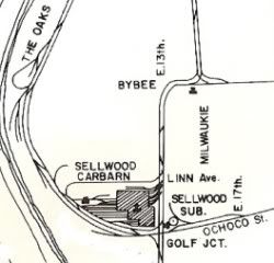
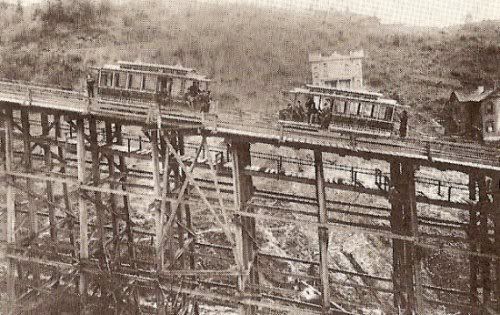
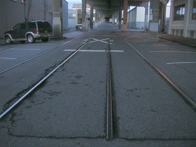
The cars either entered through the west side of the barn (the majority of feeder tracks, there), or the northern east front (perhaps an exit, only?).
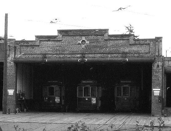
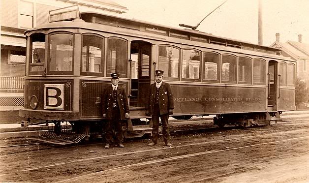
2 Here's "Car Barn B," on the west side of the building, to the extreme south. One can tell this from the first photo at the very top, as there is the long wall on the left.


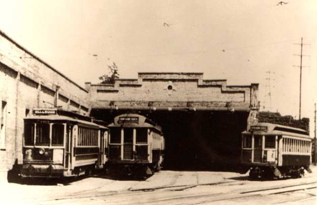
Next, we have "Car Barns B & C," although, based, again, on the very first photo, this appears to be the barn entrance to the left of "Barn B." In the first photo, there's what appears to be a fourth, smaller entrance to the right of "B." Is this "Barn A?"


This was the last standing trolley barn in Portland, and would have qualified for Portland's registry of historic buildings. Last leased to a plastics company facilty, the property was donated to Reed College by the property's owner, and shortly after the plastics company went into bankruptcy.

Assessment revealed hydraulic oil, toluene, and lead under the building and in the soil, as well as substantial amounts of asbestos in the building itself. The property was sold, cleaned, and finally demolished in 2005.
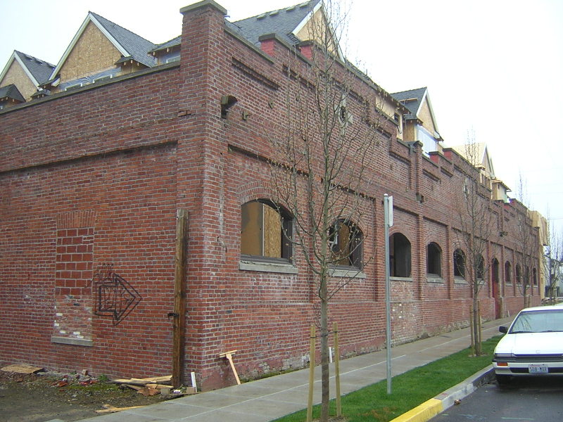
3 The east-facing original wall has been left standing.

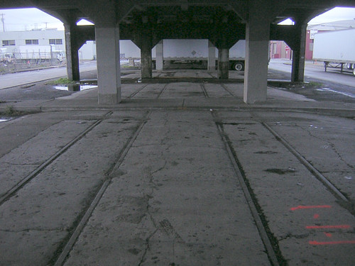
All that is left today (with new development going up) of this cavernous building today is the more southern part of the east wall, essentially the back of the building.4

image hosted by flickr.


For what its worth, the adjacent power substation still stands.5

image hosted by flickr.


As does the PRL&P administrative building, renovated and in use as office space.6

image hosted by flickr.


-d.d.

1 I have (clumsily) saved said googlemaps image of the carbarn for viewing posterity.
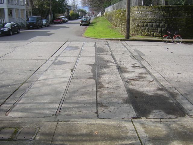
2 Adventure! over at Platial beat me to the punch in mapping the still-visible tracks on Linn Street.
3 Read the article at PDXHistory detailing the demolition.
4 The remains of the trolley barn, at Platial.
5 The OWP power substation on Platial.
6 The renovated admin building on Platial.

Tebbett's Oriental Theatre.

The Oriental Theatre (S.E. Grand & Morrison) opened in 1927 with a capacity of 2,038. Not a movie house, but actual playhouse, it did not fare well in attempts to convert it to a cinema.

image hosted by blogger

The place had an absolutely lush Hindu-inspired architectural style, though, which I absolutely adore.

image hosted by blogger
The lounge of the Oriental.

image hosted by blogger
The main auditorium, "where the sound is better."


In this detail of the auditorium, check out the carved elephants!!

image hosted by blogger
Its so lavish its almost silly.


The lobby steps.

image hosted by blogger

In this c.1930 photo a streetcar makes its way through the intersection at Grand and Morrison. The Oriental is hidden but was to the right, next door to the tall building on the corner. In the distance on the right side of Morrison you can see a pyramidal roof. This is the building that today is Grand Central Bowling. Originally it was the Grand Central Public Market.

The last hurrah for the Oriental was in 1968-69, when the City leased it as a substitute while the Civic Auditorium was renovated. In 1970 its interiors were auctioned off and the building demolished for the parking lot that stands there today.

-d.d.

Old Morrison/Mt. Tabor Line Trolley Tracks.

S.E. 26th & Morrison.

image hosted by flickr


Narrow guage. Interesting because they run out of someone's driveway, across the street, and into the sidewalk of the southeast corner of Lone Fir Cemetary. Clearly, the street grid has shifted since this line was discontinued.

Trolleys, Crashed!!

November 10, 1915.

Occurring at corner of S.W. 11th & Morrison.

Car 649, with a known history of brake problems, had reached the end of its line to the south at 13th and Hall St. The crew disembarked to victual at an adjunct small grocery. While inside, Car 649's brakes failed and the car began to roll away down the slope.

Gradually picking up sleep, Car 649 coasted a full sixteen blocks north until smacking into Car 659 at Taylor street. From there, this unholy union of two trolleys continued another three blocks before hitting a third, unspecified trolley at the intersecton of 11th & Morrison, bring this electrical trolley rampage to an end.


Six humans were also injured.

A crowd of locals gawks at the wreck in the upper left hand side of the photograph.

The New York Grocery appears to have the word MONOPOLY painted on its window.

Cars 649 and 659 were both America Car Co. Class Ks acquired in June of 1911. They were 45 feet long and approx. 8 feet wide, and weighed 39,875 pounds. They were gauged for narrow tracks (42" across). Seating capacity was 32 souls, 67 when loaded to standing room only.

-d.d.

Tuesday, April 18, 2006

Laurelhurst, the Addition with Character.

image hosted by BLOGGER


One of the secrets of the rapid expansion of Portland's trolley system c.1900-1910 was real estate development.

For example, when service began to Gresham it was a hamlet of 100 souls. A year later 1,000 people lived there. Mind you these are electric trolleys, so they bring more than a fast way to get from A to B, but light (yesteryear's Portland Railway Light and Power Company, today's PGE) and power¦ MODERNITY through ELECTRIFICATION ! !

Old Trolley Tracks Under Grand Avenue Viaduct.

image hosted by flickr


Remnants of the Bridge Transfer Line trolley tracks under the Grand Avenue Viaduct in SE Portland. The viaduct was completed c.1930, and the BT Line largely discontinued on and off again until 10 years later. The Viaduct is currently scheduled for heavy remodelling/reconstruction, and I suspect these tracks will either be paved over or torn up.

Unless someone proves me wrong, this two block strech of track is the largest section of original trolley track left in the city.

Old Trolley Tracks Under East Hawthorne Viaduct.

image hosted by flicker.


This picture is facing east. These tracks clearly are coming from the Hawthorne bridge behind me, then curve south.

Being of a wider guage, this pair of old tracks most likely connect to the old Oregon City Interurban tracks, which was, after all, the last of the old electric trains to stop service.